 Teiaiagon overlooking the Humber River Written by: Haleigh Fox
Teiaiagon (translation: “crosses the stream”) is a 17th century village built by the Five Nations Haudenosaunee (Iroquois). Located on the north shore of Lake Ontario, the area was previously occupied by the Huron-Wendat who left their territories and relocated at Wendake near Quebec City. It remains unclear as to exactly how the Huron-Wendat lost control of their traditional territory, which spans from Georgian Bay to Lake Simcoe, however, it has been suggested that they dispersed due to a combination of warfare, disease, and starvation brought on by inter-Indigenous and European conflict.
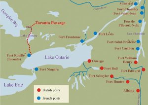
After a period of warfare which spanned from the 1640s and 1650s, the Seneca tribe established Teiaiagon along the Humber River at some point in the 1660s. Teiaiagon is one of a string of villages, which include Ganatsekwyagon, that were strategically placed in order to control hunting territories and trade routes throughout Ontario. Specifically, the village is significant as it connects to Lake Simcoe via the Toronto Carrying Place portage and allowed villagers to oversee traffic along the river and port leading to Lake Ontario. By controlling this area, the Seneca could act as intermediaries and control the fur trade between the English, Dutch, and French who were active in what is now Southern Ontario, New York and Quebec.
The name Teiaiagon and its variations (Taiaiako’n, Taiaiagon, Teyeyagon, and Toioiugon) appear on early French maps of Lac de Frontenac (now Lake Ontario) and the earliest written accounts of Teiaiagon are from European travelers. French missionary Louis Hennepin, is said to have stayed in the village for some time and lists Teiaiagon as having 50 longhouses and 5000 inhabitants. The village was built in Haudenosaunee style which includes longhouses within a fenced off area. Other reports mention the village being surrounded by agricultural fields where villagers harvested corn, beans, pumpkins, and tobacco.
Occupation of the village lasted until 1687 and its abandonment remains unclear. This may be due to natural movements as Haudenosaunee villages are not meant to be permanent and the Seneca relocated to their traditional territories in New York. It is also possible that the village was left due to French military threat. By the time the Marquis de Denonville, Governor General of New France, had reached Teiaiagon the village was empty. Another theory, as argued in the Ojibwe oral tradition is that at the same time their tribes descended upon the Haudenosaunee in battle and emerged victorious.Although we do not have a definitive answer as to why the site was abandoned, by 1696 the Teiaiagon area was occupied by the Mississaugas, the Anishinaabe, and French. Trade flourished during the Great Peace of Montreal in 1701, the Mississauga had a village located on the west bank of the river and eventually the French built a fort called Baby Point in 1750. Overall the site was left relatively undisturbed until the development of the Baby Point subdivision in 1912.
 French map of Lake Ontario depicting Teiaiagon
| In the early 2000s the undisturbed burial plot of a Seneca woman was discovered dating to the 1680’s. The site contained a moose antler comb, engraved with a bear and a rattlesnake-tailed panther, which may possibly represent Mishipizheu. The design of the comb is elaborate and depicts a human form connected to the animals.Bill Woodworth, a Mohawk member of the Six Nations living in Toronto has the following to say about Baby Point and the discovery of the burial:
“Four hundred years ago, present day Baby Point was occupied by the Seneca Iroquois longhouse village of Teiaiagon (“crosses the stream”). The spirits of our native ancestors, including their bodies and the remains of their longhouse lifestyle were “returned to the earth” here. This is the land on which Robert Home Smith developed a beautiful early twentieth-century Eurocentric enclave. Much of the native settlement is still held in the earth there undisturbed except for the house foundations. In the spring of 2007, the ancient burial of a native woman was uncovered. This recovery was a stark remembrance of the origins of this place. Among the items discovered with her remains was the bone comb pictured here. For me, this comb conveys to us here now the sublime spiritual nature of this woman’s gifts.
According to provincial statute, Six Nations of the Grand River were contacted, and a re-burial location negotiated with the City of Toronto Culture Division. As a Mohawk member of the Six Nations community living here in Toronto, I was called on as a man, by some of the Clan Mothers, to deliver the speech in the ceremony of re-interment. In our ceremony, we apologized to the spirit of her bones for uncovering her peaceful remains held so long undisturbed amidst the many layers of subsequent occupation. We prayed not to disturb her bones again, and in return, we asked her not to hurt us in our unintentional carelessness today.” |
|
|
|
|


Leave a comment